Future City L. A. Part III- PLURALIST INFRASTRUCTURES
This blog entry is the third of a series by CRTKL’s Nate Cherry that investigates changing attitudes and with them, the changing physical environment of Los Angeles.
When considering the future of Los Angeles, it’s interesting to look at the changing role of its infrastructure. I would argue we are experiencing a transformation in our infrastructure from singular to plural.
Let me explain.
SOME HISTORY
Los Angeles’ development is traced to early settlements along what is known today as the L.A. River. The alluvial L.A. basin was a perfect place for food production, and small villages cropped up in between large areas of groves, vineyards and ranches. But the river meandered, and its path was both unstable and unpredictable. Flooding during the rainy months caused property damage, injury and even death. Eventually, in the 1940s, the river was channelized by the Army Corps to do one thing—get the water out of the L.A. basin as fast as possible. The channel was not meant to be beautiful, but the areas adjacent to the river, now predictably dry, were ideal for industries that processed food, oil, and manufactured products.
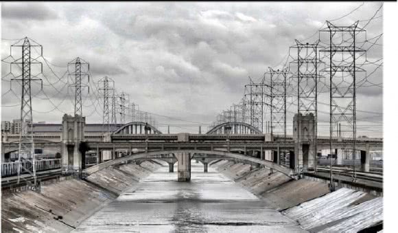
The L.A. River channel in its current configuration is an example of singular infrastructure. It has a sole purpose and design. It does not improve water quality; it does not provide an amenity to adjacent users. Areas adjacent to the river were largely developed as isolated industrial areas or working class neighborhoods, but were never considered “river adjacent,” as in areas tied to an amenity that increases land values.
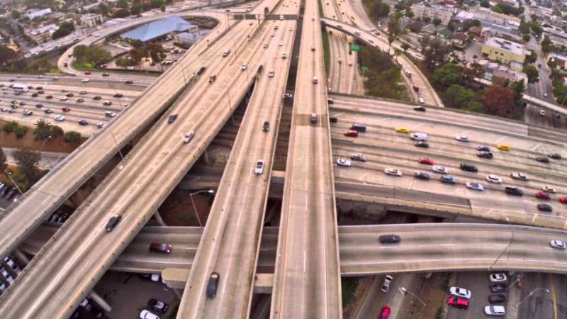
Later waves of development in L.A. came as a result of progressive innovations in transportation. In the early part of the 20th century, there developed a number of train suburbs that were served mostly by the Huntington Red Cars. Of course, the explosive growth in the city also came with the adoption of the automobile by the middle class. Newfound affluence created a market for greater housing choices outside the city center, and thus the suburbs were born. Single detached houses replaced orange groves, and freeways and arterial street networks were built to serve cars and trucks only. They, too, are examples of singular infrastructures.
DEFINITIONS
Among other meanings, Merriam Webster defines the term infrastructure as, “The fundamental facilities and systems serving a country, city, or area, as transportation and communication systems, power plants, and schools,” while it defines the term pluralist as, “Relating to or advocating a system in which two or more states, groups, principles, sources of authority, etc., coexist.” The two words pluralist and infrastructure together, then, describe a state in which we are asking our engineered systems—our roads, our bridges, our riverfronts, our transit ways—to do more than one thing at a time. Our resources are finite, and as populations grow, it is important to think about how we can make our infrastructures more multifunctional, more plural in their capabilities.
PLURAL INFRASTRUCTURES
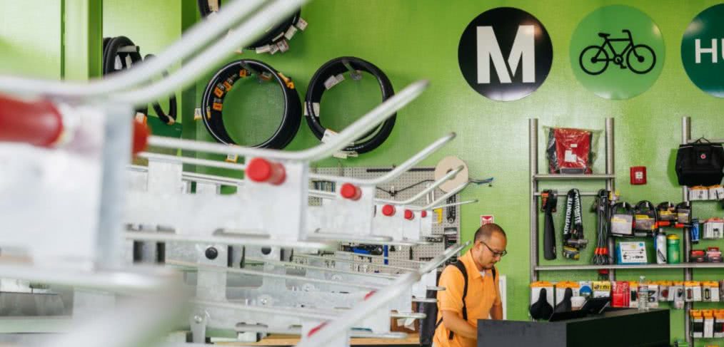
METRO BIKE HUB
Georgia Sheridan oversees Metro L.A.’s urban design division. She will tell you that, although the light rail system in Los Angeles has been a huge success (ridership is already 2nd in the country in terms of total numbers), the suburban pattern of the city has limited the effectiveness of those who want to ride transit more than a mile away from the station.
“The first and last mile of the transit users journey is the key,” she says.
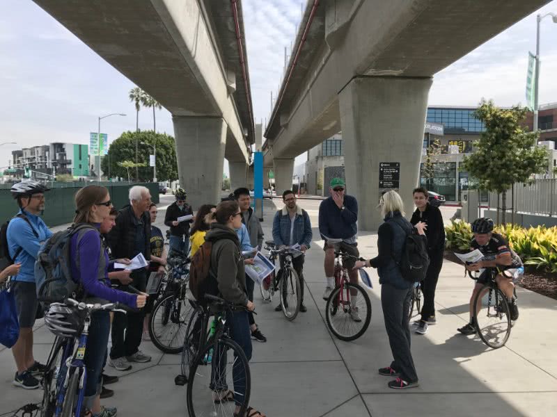
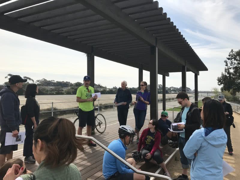
She toured the Expo Line Station with me and a number of interested citizens a few weeks ago.
“Some of the challenges with the station in its current design are the elevated rail lines. It’s cheaper to build elevated rail and less disruptive to the existing city function, but it is harder, obviously, to access the platforms. We have to make it as easy as possible for people to use transit. We can’t control what local municipalities do with their streets connecting to our stations, but we can control what happens in our right of way. Bike ridership to and from Culver City station is among the highest in the county. The current bike parking only accommodates 24 lockers, and we have a huge waitlist for the lockers; so, we decided to take advantage of the underside of the elevated rail, take out the bike lockers and create a full bike hub which will have 64 spaces, full time staff/mechanics, 24/7 membership access bike tools, bathrooms and even some retail. We will also be offering classes and clinics on how to ride in urban street conditions.”
Meanwhile, immediately adjacent to the train station, Ivy Station is going up. It’s a mixed-use project that will replace surface parking used to serve the station. Ivy station will have 200 residential units, a 148-key hotel, some retail, public open spaces and replacement parking for the station.
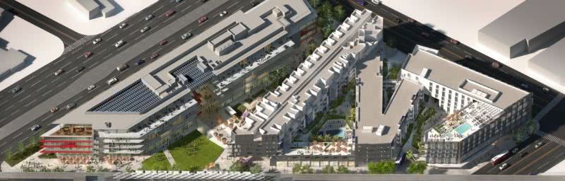
Both the Ivy Station development and the Bike Hub are example of pluralist infrastructures. Where previously the underside of a rail station and surface parking sat, new developments will do several things—provide better parking, bike services, new retail, open spaces and amenities.
MILTON STREET PARK
Another example of the transformative power that pluralist infrastructure offers can be seen at Milton Street Park, adjacent to the Ballona Creek Channel in Culver City. I toured it with Ying-Yu Hung and Trent Okumura, both of SWA Group and the lead designers of the park. They worked with a team of engineers and a consortium of regulatory agencies led by the Mountains Recreation and Conservation Authority.
Here’s what they said:
“Our biggest challenge was convincing the many stakeholders—adjacent homeowners in Marina Del Rey, the Army Corps, L. A. County, the City of L. A. and a nearby school—that a high-performance green space that brought people together was a good idea.”
“When we started our work, we had lots of outreach meetings; and at first there were a lot of turf battles and a lot of fences to deal with—literally. The site had half a dozen interest groups invested in physical barriers that we had to break down. There were a lot of culture clashes; the bicyclists were scary to residents; the middle school was worried about strangers coming to the area. We started showing them design concepts, explaining the natural processes happening in the area, trying to change their perception about the site, and instead got them excited. We showed them all the natural features the site already has—the natural flows of water, flora and fauna, all despite these man-made barriers. ”
“The park is long (almost a quarter of a mile) and very narrow (only about 30-FT wide), so we had to do a lot in a compact area. The park includes a bio swale and vegetated stormwater curb extension areas that capture and cleanse runoff water that is slowly released into the Ballona Creek. Gabion walls are made from on-site rubble and provide retainage for informal seating areas, and native plants provide habitat and a food source for local fauna. There is a grand stair that connects the school to the park and the bike trail. We also integrated bike racks and a shade trellis for passive enjoyment for both cyclists and pedestrians. As soon as we finished the design, people had completely changed their attitude; instead, they were impatient to see the park open as soon as possible.”
As soon as the park was opened, it was a success. There have been no major incidents, and now properties adjacent to the park and all along Ballona Creek are opening to take advantage of the waterfront as an amenity.
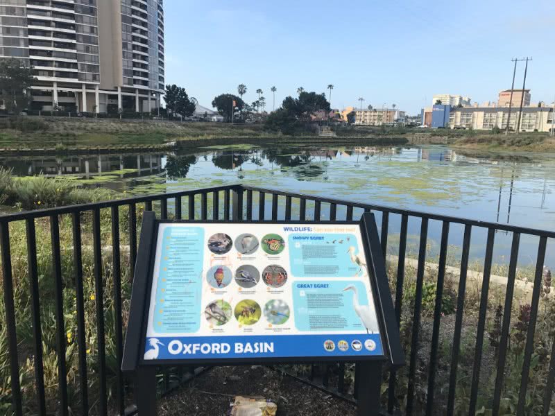
OXFORD BASIN
Originally part of the Ballona Marsh, Oxford Basin had been used as a municipal dump until the late 1950’s when the site was converted into its current function as flood control at the request of the Audubon Society. The Oxford Basin Multi-Use Enhancement Project is a multi-benefit project developed over a six-year period in consultation with stakeholders and the community. It aims to enhance Oxford Basin’s flood control functions, improve the habitat and water quality and provide new recreational and safety amenities.
Per Joshua Svensson, P.E., project manager, there are 6 priorities for the project:
- Flood risk management: “Several streets and properties in the area surrounding Oxford Basin are near or below the level of high tides in the marina. Prior to a storm, public works crews operate Oxford Basin’s tide gates to empty Oxford Basin at low tide, creating a storage capacity that allows surrounding streets to drain into Oxford Basin during high tide. These storm flows are then emptied into Marina del Rey at the subsequent low tide.”
- Better water conservation: “This project is an example of L.A. County becoming nimbler, acting on smaller scale projects that improve water conservation. In the past, this priority was limited to dams and other large facilities.”
- Improved water quality: “The project removed approximately 3,000 cubic yards of contaminated sediment and soil. We built a circulation berm within the basin to improve dissolved oxygen levels and promote a more natural tidal exchange. We also constructed three bio-retention water filtration systems.”
- Preservation of native habitat: “California’s native plants are being used throughout the project area. They are uniquely adapted to thrive in the local climate and soil types and to support native wildlife. In addition to their ability to provide the best possible habitat for native wildlife, there are many other benefits including reduced irrigation requirements and lowered maintenance needs.”
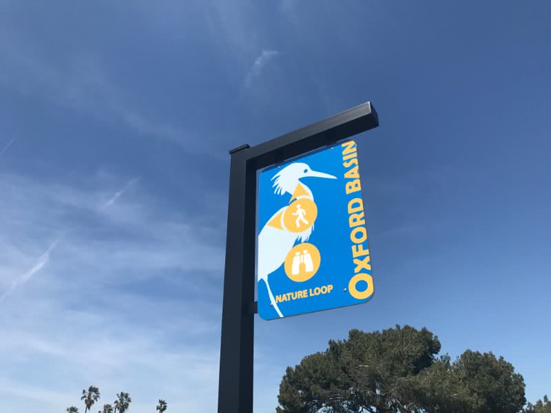
- Increased recreation and safety: “The bike path through the site is enhanced by the addition of a separate walking path, allowing cyclists and pedestrians to more conveniently share the bike trail in this location.”
- Improved aesthetics: “You will see that we focused a lot of time and attention on viewpoints, seating and interpretive areas that help to improve the experience of the basin. The Oxford Basin reduces potential sources of unpleasant odors through increased tidal exchange, increased circulation and removal of accumulated sediment.”
As we become a denser city, more constrained in both time and space, we must become more plural in our actions. We want to shift from one activity to the next with greater fluidity. Technological innovations have driven this change. With smartphones at tablets, the separation between the office and home is blurred. E-bikes and autonomous vehicles promise that commuting can combine a bit of recreation, business, entertainment and education.
Ultimately, we all want more choice—the ability to choose between several desirable options for how we work, how we move and how we live. Therefore, one of our primary modern challenges as planners and urban designers is to make our infrastructures more plural—to make them do more things for us, simultaneously.
CallisonRTKL
Latest posts by CallisonRTKL (see all)
- Learning the Language of Sustainability - October 17, 2017
- Renting Isn’t Just for Millennials Anymore - January 10, 2017
- Off the beaten path: is an architectural revolution in store for Cuba? - January 5, 2017
- Holiday Gift Ideas for your Mother (Earth) - December 16, 2016